The land promised to Abraham, shown on our maps era by era, in story order.
God promised the land of Canaan to Abraham’s descendants. Its borders are described in more than one way in Scripture, and the land Israel actually held changed over time. Each map below shows one moment, with its verses and what we could not show.
The text says
The land promised to Abraham’s descendants is called Canaan, and later Israel and Judah.Gen 12:7; Num 34:1–12
Debated
The borders of the promised land are described differently in different passages (compare Gen 15:18 with Num 34), and scholars disagree about how they relate to the borders Israel actually held.Gen 15:18–21; Num 34:1–12
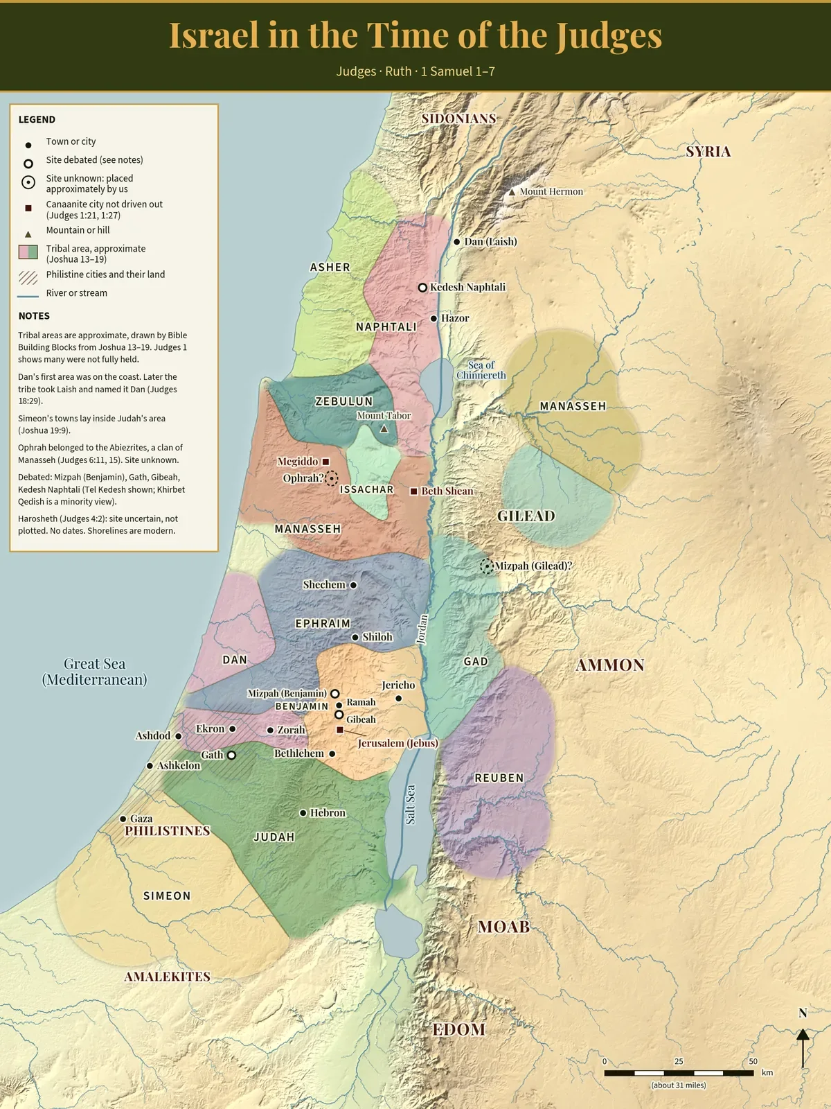
Israel in the Time of the Judges
Israel in the time of the Judges. Boundaries are approximate. Select the map to view it full size.
The tribal areas are approximate. We drew them from the town lists in Joshua 13–19, and Judges 1 shows that many were not fully held.
Open circles mark sites that are debated: Mizpah (Benjamin), Gath, Gibeah and Kedesh Naphtali. Ophrah’s site is unknown, so its ring is placed by us.
The map shows no dates.
Built by Bible Building Blocks from public-domain and open data: elevation from the US Geological Survey, coastlines and rivers from Natural Earth, and town points from Wikidata. Names follow the World English Bible, each checked against its verse. Shorelines are modern.
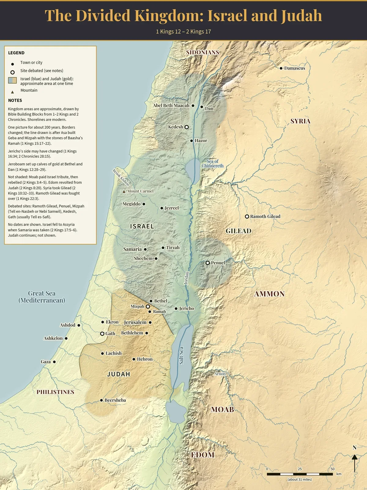
The Divided Kingdom: Israel and Judah
The kingdoms of Israel and Judah at one time. Areas are approximate. Select the map to view it full size.
One picture stands for about 200 years, and the borders changed. The line drawn is after Asa built Geba and Mizpah (1 Kings 15:17–22).
The kingdom areas are approximate, drawn by us from 1–2 Kings and 2 Chronicles. Jericho is shaded as Israel only because a man of Bethel rebuilt it in Ahab’s day (1 Kings 16:34).
Open circles mark debated sites: Ramoth Gilead, Penuel, Mizpah, Kedesh and Gath.
Built by Bible Building Blocks from public-domain and open data: elevation from the US Geological Survey, coastlines and rivers from Natural Earth, and town points from Wikidata. Names follow the World English Bible, each checked against its verse. Shorelines are modern.